Using AI Assistant to Discover Imagery
In this section, you will learn how to use the AI Assistant to search imagery, add it to cart, view footprint, and order it.
The following instructions serve as a guidelines for using AI-driven prompts to search archived and future satellite imagery.
Due to the prompt variability introduced by the AI's natural language generation, responses may differ slightly; however, the core objective remains consistent: searching and ordering relevant imagery and satellite data.
Discovering Imagery
In this section, you will learn how to discover relevant imagery with the help of AI Assistant.
As a user, you could provide the imagery parameters such as date range, region, task (palm tree detections, oil spill detection, etc) to the AI Assistant. The AI Assistant will then display the search results of the relevant imagery.
The procedure is the same for both archived and future imagery.
For illustration, the following steps show how to order archived images.
To search for imagery, do the following:
-
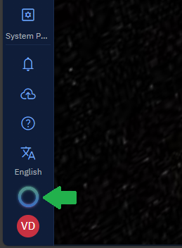
Click the AI Assistant icon to open it.
-
In the AI Assistant, type a prompt, such as:
I want to do palm tree detections in Abu Dhabi from 1 Nov 2024 till date.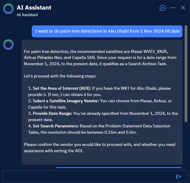
-
In the AI Assistant, type a prompt, such as:
Select Airbus and set a WKT for Abu Dhabi region by yourself.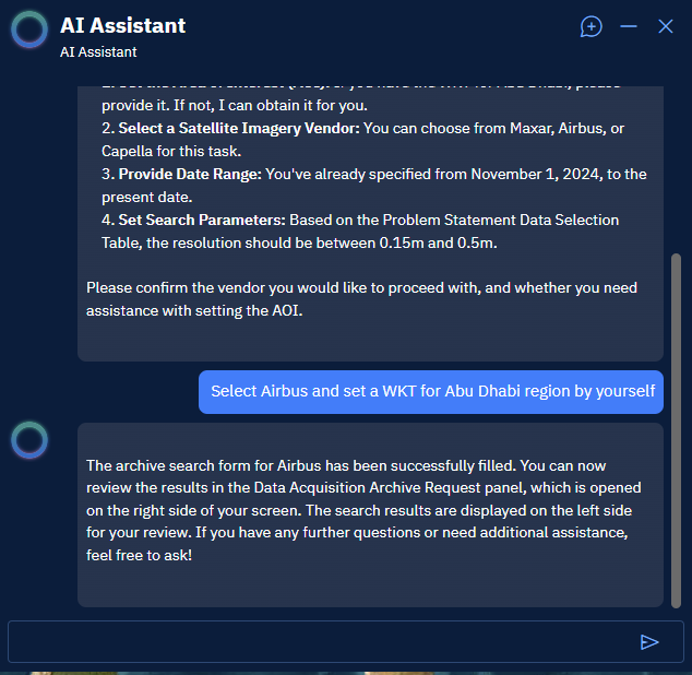
The AI Assistant does the following:
-
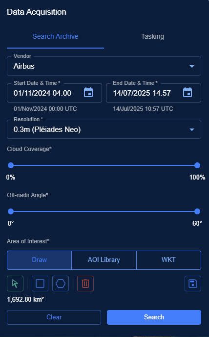
Fills the Data Acquisition dialog box automatically with all the relevant information needed to search appropriate imagery.
-
Displays all the relevant imagery in the Search Results panel.
Viewing and Ordering Imagery
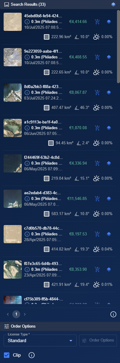
The AI Assistant displays all the relevant imagery in the Search Results panel. You can view and order one or more images from the Search Results panel.
Each relevant image result includes:
- Unit price of the image - View the price and confirm if its within your budget
- Order icon – Click to add the image to the cart and order the image
- Show Footprint icon – Click to view the image footprint directly in the map view.
To view and order imagery, do the following:
-
In the Search Results panel, locate an image that you want to buy, and do the following:
- Click the Footprint Visibility toggle button to turn on the footprint of the imagery on the map.
- View the price of the image.
-
Click the Add to Cart button to add the imagery to the shopping cart.
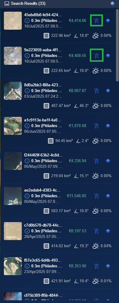
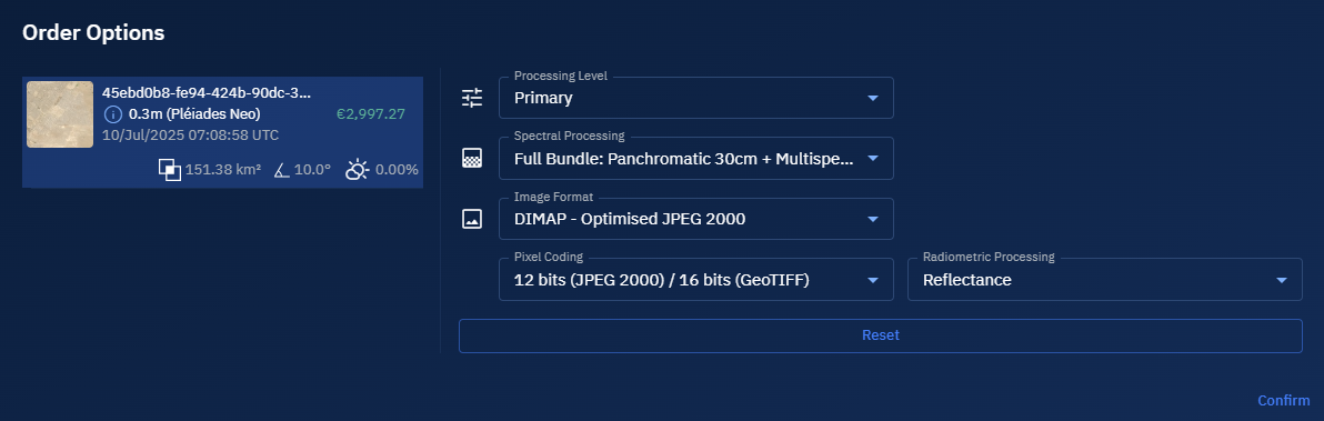
The Order Options dialog box is displayed.
- In the Order Options dialog box, do one of the following:
-
View the default parameters selections presented by the AI Chat and then click the Confirm button.
-
Select the appropriate options to override the AI Chat and then click the Confirm button.
-
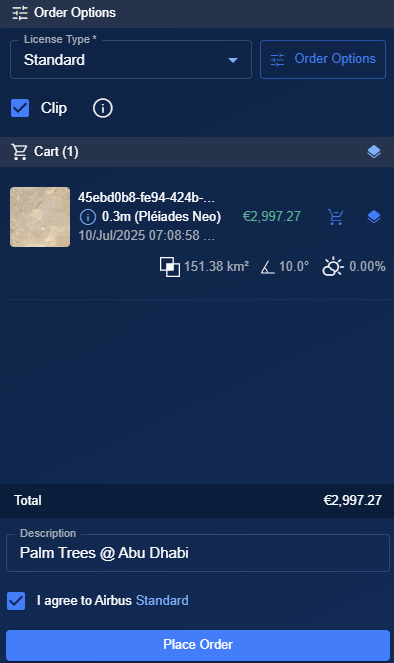
The selected imagery is displayed in the Order Options panel.
-
In the Order Options panel, do the following:
-
Click the License Type drop-down list and select an appropriate type of license.
-
Type an appropriate description in the Description box.
-
Select End User Agreement checkbox
-
-
Click the Place Order button to buy the archived imagery.
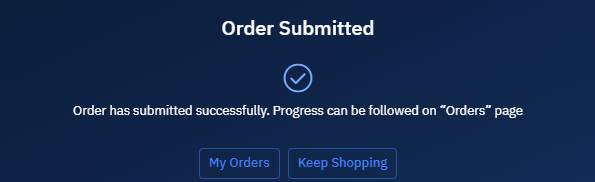
The order is successfully placed.
-
Click the My Orders button to view your imagery order in the Orders sub-module.
You will receive a confirmation message in the email once your order is successfully placed.
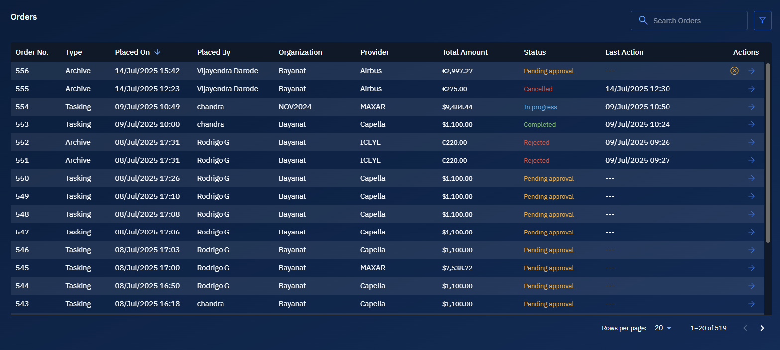
Cancelling Imagery Order
In this section, you will get to know how to cancel an order.
To cancel the order, do the following:
-
Login to the platform.
-
Click the Acquire module and then click the Orders sub-module.
-
In the Orders sub-module, locate the order that you want to cancel and then click the Cancel icon.
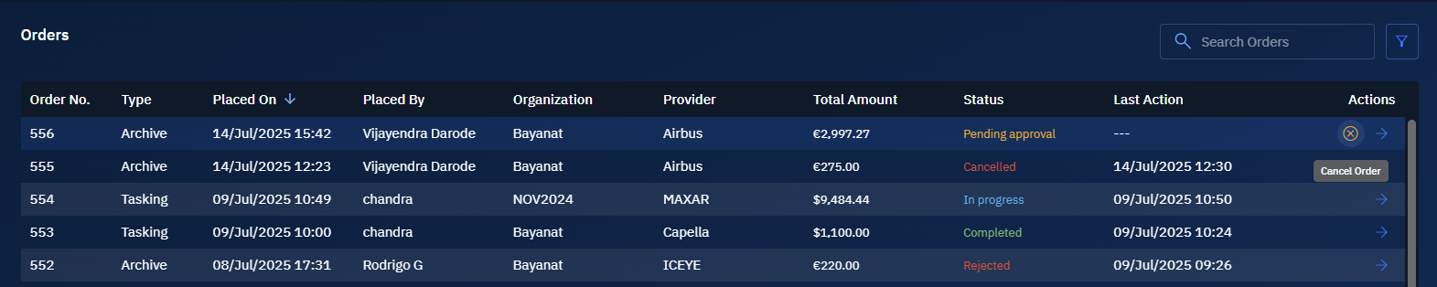
The order is immediately cancelled.
